Add Survey and Edit Survey
Objective
The Add Survey function is used to make a add a new survey to the DigitalRockArt database. One member of the recording team is designated as the recorder of the survey. The survey recorder is responsible for completing the computer recording aspects of the survey.
The Edit Survey function is used to change or correct site names, numbers, or survey recorder. The Add Survey and Edit Survey functions are accessible only by persons with an administrative ID.
Processing
The Add Survey function prepares a folder of images or photos for more processing by subsequent functions. Prior to this step, the survey information and images have been received from a recording team and the folder of images has been copied to the web server.
Note there is a distinction made between a site and a survey. There may be multiple surveys made over time for the same site, or large sites may be broken into smaller sections for ease of recording or the use of multiple survey teams on the same site. The Add Survey function will add both a new site entry and a new survey entry to the database SQL tables, or add a new survey entry for an existing site.
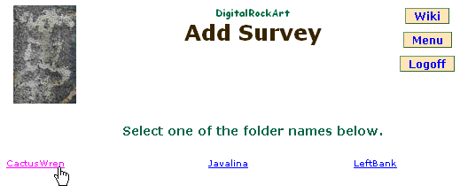
The first step is to select a survey from the list of those available. The list of surveys for Add Survey is created from the folders or directories within the server file system that do not have a corresponding entry in the SQL database tables. The list of surveys for Edit Survey is created from the database SQL tables.
 |
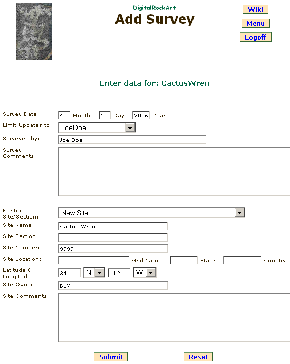
The second step requires filling in the fields of the form. Note the Section field is frequently left blank.
Field |
Description |
Date |
The date the photos were originally taken. Year values of 0 - 50 are assumed to be 20xx, 51 - 99 are assumed to be 19xx. |
Surveyed By |
Name or initials of person(s) performing the survey. |
Survey Comments |
Names, phone numbers, and email addresses of surveyors. |
Site Name |
Name of site as approved by land owner/manager. |
Site Section |
Use only if the survey is for a portion of a large site. |
Site Number |
The local site number, usually a state number or land manager number as approved by the land owner/manager. |
Latitude & longitude |
Latitude and longitude rounded to 2 degrees, e.g. 33.10000 will be rounded to 34 and 32.99999 will be rounded to 32. |
Site Owner |
Use "Private" if site is owned by an individual. |
Site Comments |
Name, phone number, email address of site owner or manager. |
 |
Buttons
Submit: Adds the data to the database. In addition, information from each image file within the folder is collected and placed into the database. A folder of several hundred photos may take a minute to process so be patient.
Reset: Resets all fields to the values received from the sever -- undoes all updates.
Menu: Returns to the menu.
Logoff: Logs you off the DigitalRockArt application.
When processing is complete, the menu is displayed with a message stating the number of images processed.
 DigitalRockArt Wiki